For PDF Version with more photos (and quicker download), click here.
For scanned image of this article printed in Utah OutDoors Magazine, click here.
Poundin' Out the Paiute
August 2000
What is it with men and the combustion engine?" asked my friend Michele when I told her what we had just done. I started to formulate a logical answer that she couldn't misunderstand and then just said, "They're cool!" Describing the trip proved to be almost as difficult. There is no way to verbally communicate even a portion of the urban static mind purging that three days of intense riding through some of Utah's most scenic and remote landscapes can produce. It was exhilaratingly exhausting, visually drenching, sun burningly 'cool'!
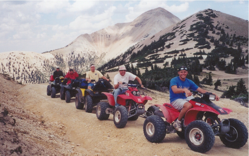
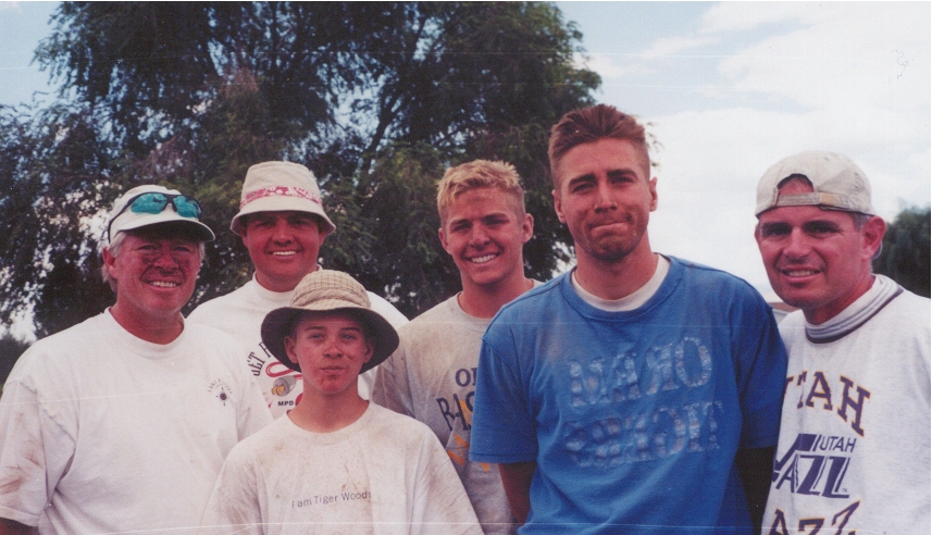
Earlier in the summer, I was stretched out on the grass talking to my neighbor Dave and his wife Kerri as the setting sun lit up the evening sky in flames of gold and red. "Have you been on the Paiute Trail?" he asked. I had lived in Utah for over ten years, thought I had hit every major Utah attraction at least twice but had never even heard of the Paiute Trail. Dave's oldest son Mike would be getting married in a few weeks so when he invited me to join them and Mike's younger brothers K.C. and Geoff and another friend David for three days of wild riding, I jumped at the chance. Four wheelers, coolers full of food, high octane gas and the guys from the cul-de-sac ... I couldn't think of a better bachelor's party combination.
The Paiute Trail is a network of all-terrain vehicle (ATV) trails that snake through the diverse scenery of south central Utah. A recreational joint venture administered by the Fishlake National Forest, the Bureau of Land Management and Utah Division of Parks and Recreation, the main trail (Paiute 01) is a complete circular loop that wanders 275 miles through the mountains around Utah's Richfield valley. You can do the whole thing plus a few side trails in three days--if your throttle thumb doesn't give out.
We entered the loop in Aurora at the city park where there was plenty of parking and it was safe to leave our trailers and tow vehicles. A small pavilion at the north end of the park displayed a large map of the entire trail and instructions on how to get to and follow the trail from city center--not too difficult considering Aurora's population is just over 900. As long as you follow the signs marked Paiute 01, you won't have any problem.
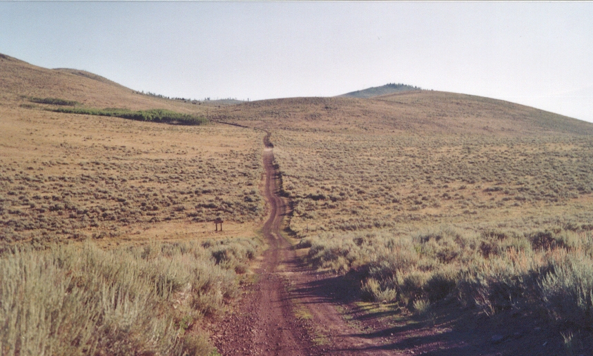
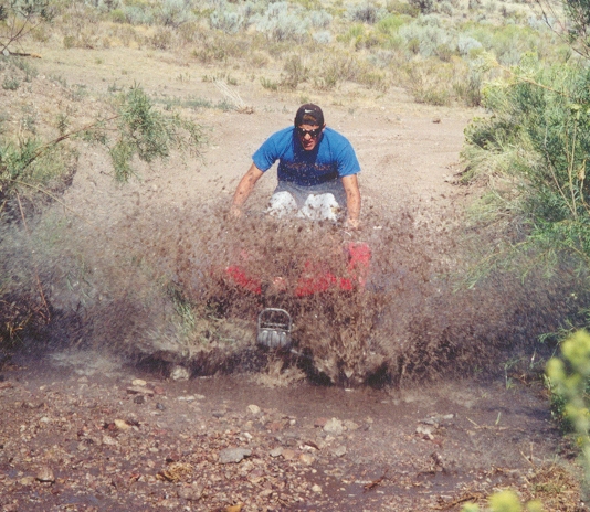
From Aurora , the trail gives you a taste of the old west--dust, rock and sagebrush. You get a cowboy view of cattle trails, watering holes and an occasional red or black beef critter. You just might wear a bandanna to keep from swallowing dust. On the sometimes powder dirt tracks a four-wheeler ('quad' for short) can throw up a cloud equivalent to a stampeding herd of cattle. From a rocky ridge, we descend into Frogs Flat which looks like a dry lake of sagebrush.
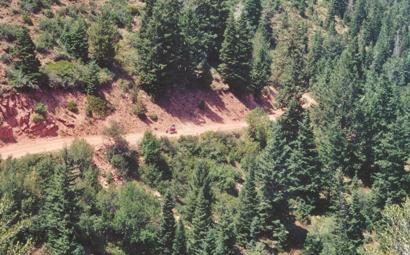
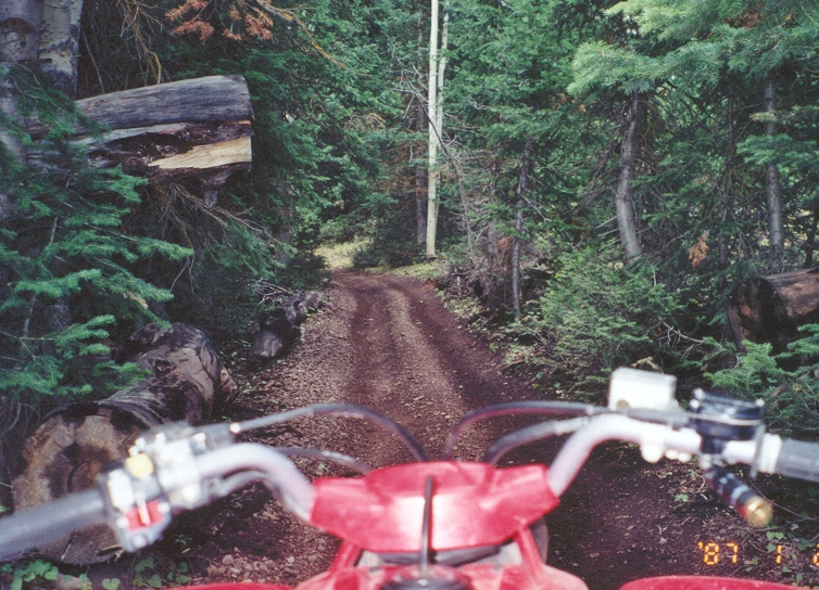
On the Paiute, the ride is never boring. From the heat baked red dirt we were soon switchbacking upwards along tree shaded trails with a noticeable relief in temperature. The intense fragrance of pine, the strobing effect of sun through the branches and the sweeping vistas increased until we reached the top and stopped to rest. On this first leg, we climbed over 5000 feet to Sand Rock Ridge at an elevation of 10,200.
Our quads were a mixed bunch. The Polaris 500s with all-time four-wheel drive, comfy ride and fore and aft racks were loaded with gear and extra fuel cans. The Honda 400 EXs have a tighter suspension and are equipped with chain rather than shaft drives. They handle more like a sports car with rear wheel power, good acceleration and a lower center of gravity--great for power slides and jumps.
The ridge route for several miles is a good road with small herds of cattle grazing among groves of tall, white-trunked quaking aspen. From the ridge you can see the Sevier Dessert to the west and Vermillion Valley to the east. The occasional cattle guard or erosion control gully provides an excellent launch pad for some good air.
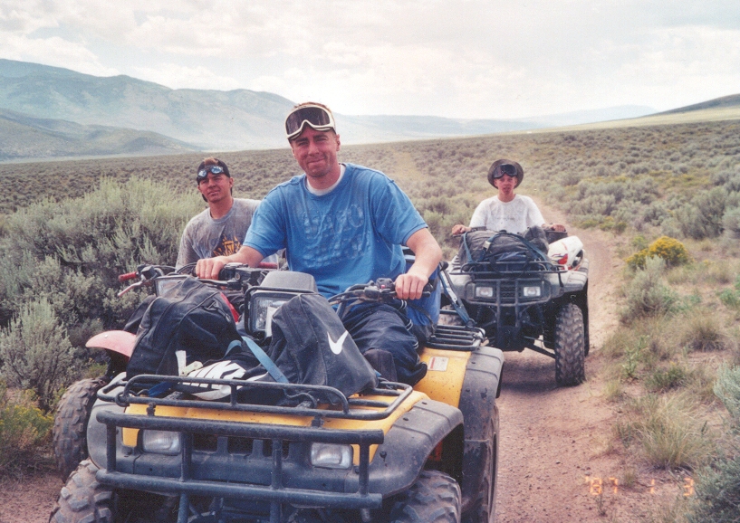
We lengthen the separation between us so that each rider can have a relatively dust free view. The lead position switches often between K.C. and Mike. They have been riding quads for several years and are safely competitive. On a long stretch, the lead changes back and forth several times and then they settle back into formation through a winding stretch of trees. Geoff at 14 keeps a comfortable steady pace that is never more than a few minutes back. From the plateau, we start a gradual descent towards the town of Richfield passing large sandstone boulders, red earth and twisted juniper trees.
For those of us who love the exhilaration of the outdoors but don't necessarily like to cook there, the Paiute has side roads leading into several Utah towns--some of them even have restaurants. Richfield is an 'ATV friendly' place with a healthy selection of lodging and dining facilities. There's nothing like a sauna, soak in the Jacuzzi and a dip in the pool after a long day of hard riding. Helmeted ATV riders on properly licensed machines can ride anywhere in town at 10 m.p.h. or less. We found the Days Inn on the same street as the trail into town and dined Mexican style at Pepperbelly's.
Evening brought a spectacular thunder storm and rain that cooled the valleys and dampened the trail. Next morning we dried off the machines, motored the few short blocks to the trailhead and climbed back up to the ridge line. The angle of the morning sun lit up the aspens in shimmering green and we rode for several hours drinking in the scenery and the scent of wet sagebrush and pine. No dust makes a big difference.
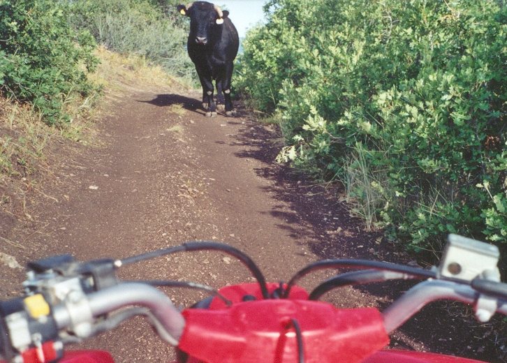
The Paiute in August was surprisingly free of traffic. On day two we met up with the only caravan of quads that we would encounter on the entire loop. The lead rider signaled how many machines were behind him and we counted five before resuming cruise speed. Around one corner we met a formidable blockade--a black Angus bull stationed resolutely in the middle of the trail. After a little prodding, he broke off his territorial stare and ambled off through the brush.
The scenery changed (again) as we came across what appeared to be a lunar landscape--a flow of volcanic rocks stretching off in the distance. A fence had been built across the surface and around each post was a pile of lava rocks to hold it in place. After some good trail riding, we descended through twisted juniper and white rock to the Fremont Indian reservation and crossed underneath Interstate 70.
It's not a bad idea to be mechanically prepared (in addition to being mechanically inclined). We had two minor difficulties that could have been disastrous if the problems had not just happened to occur when we were close to civilization. One of the rental machines burned oil to the point it was running rough and was in danger of seizing. Fortunately a friendly caretaker at the Indian museum just happened to have a case of oil in the back of his pickup. He gave us a couple of quarts and we had to twist his arm to get him to take payment. On another occasion, one of the tires was going flat due to a small puncture. We happened to discover it in one of the only three towns that we passed through on the trip. We pulled over to the grocery/gas/garage/post office and the grocer/attendant/mechanic/postman fixed it for a buck. A word of advice, take a tool kit, oil, a patch kit and pump in addition to extra fuel.
Leaving the Fremont Indian Museum, it is a spectacular climb to the treeless tops of the Tushar Mountains. The path threads narrow trails of dense pine, through mountain streams and past an abandoned gold mine. The mine shaft was partially caved in and filled with water but the tailings rails are still in place and so is the cabin where the early Utah miner and his wife raised 10 kids.
We followed a shimmering river that dwindled to a stream the higher we climbed. The tops of the Tushars are at 13,000 feet and look like giant yellow dunes of drifted shale rock. Near the summit, the wind blew and the temperature dropped as we crossed to the south and started the descent. The scenery cycles between alpine meadows, pine forests and quakie groves. Racing through Buck Meadows, we scared up a couple of does that bounded along just ahead of us leaping over fallen trees and eventually disappearing into the pines.
The steepest descent of the trip begins in the mountains above Circle-ville. Several years ago a wildfire swept over a ridge of quaking aspen and left a forest of black stalactites. The trail is a series of tight switchbacks that must be carefully navigated with a heavy application of brakes. We dropped thousands of feet in less than an hour and find ourselves in a boulder strewn delta with road rocks the size of footballs. The trail leads to the valley floor and we were soon riding through alfalfa fields pungent with the smell of fresh cut hay.
Circleville (population 417) has two choices for lodging--our party completely filled one of them by taking all three rooms. We paid the $25 per room to the proprietor in his living room and then headed to the only eating establishment in town. On an outer road we found another pavilion with an extensive map showing the intersection of the Paiute and Fremont ATV trails. The Fremont is another network which stretches far into southern Utah. It was evening in Circleville, everyone was done milking and the most happening thing seemed to be the slow moving water in the irrigation canal. We watched float lazily for a while and then idled back to the motel for a good nights sleep.
On day three, we were off before it was even light. With at least eight hours of riding ahead of us we needed an early start. As dawn breaks, we were chasing jack rabbits across miles of sagebrush and rock. We paused at the top of a ridge to wait for the last ATV which looked like an insect with headlights and a billowing tail of dust winding its way up the hillside.
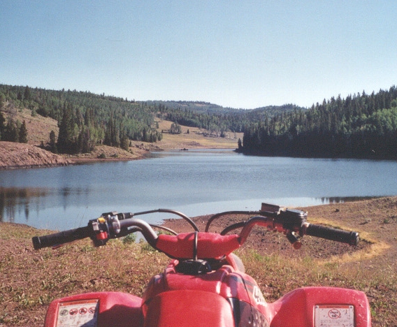
During most of the trip, we stick together and stop regularly to make sure no one gets lost. Sometime during mid morning the distance between us began to spread and when we stopped to take count, one of the group was missing. Six or eight miles back, the road split and Mike had taken the lower road. While Dave went back to find him, we warm ourselves in the morning sun, survey a lake in the valley far below and roll rocks for entertainment. Across the valley to the west, we see the Tushar range that we traversed the day before.
Day three's ride was much faster and the scenery was spectacular. Once into the mountains, we entered Fish Lake National Forest where the roads were made for full size vehicles and we could really rip. We knew that forest fires had been raging in central Utah somewhere in this area but didn't know exactly where. After a long ascent, we came upon a Forest Service employee, sitting in his truck reading a book. "Didn't anyone stop you down there?" he asked. "This road is closed due to the fire--you'll have to go back." It was a loooooooong way back and even if we did turn around, we weren't sure how to find our way to the next point. After a few minutes, he reckoned that the fire was out and the crews were just doing cleanup so we could proceed if we did so carefully. We slowed to a 10 m.p.h. caravan speed and stayed close together.
Blackened ridges and the smell of smoke met us at several turns. In a couple of places, we could see where the fire had burned right across the road. Today however, the sky was an intense clear blue and the couple of fire crews that we met were just checking hot spots and tidying up their equipment.
From Fishlake Forest we dropped into Koosharem and encountered the last major scenery change of the trip. We took dirt roads through cattle and sheep ranges and crisscrossed a paved highway several times. At one point, we met a caravan of quads coming from the other direction and on closer inspection realized it was the same one we saw on day one--we had met them coming around on the other side of the loop!
More sagebrush, juniper, and a few streams and ponds. This segment allowed for some fast free wheelin. There were long straight ribbons of twin dirt tracks that paralleled fence lines. Tall sagebrush on each side whizzed by with the occasional puddle of muddy water that you had to careen around to keep from getting soaked. On more than one occasion, we got spread out and someone ended up taking a wrong turn that required a reconnaissance effort to get us back together.
With the descent in altitude, the afternoon sun began to bear down. The air was like a hot blast but slowing or stopping made it even hotter. We finally reached the Salina and navigated the back streets until we found an open road with signs indicating the way back to Aurora. The irrigated fields of green alfalfa and corn were a stark contrast to the arid region we had just passed through.
On the north end of town, we throttled back to a comfortable 10 miles per hour and motored the four blocks that took us from the edge of town to the park at city center. As we pulled up to our transport vehicles, our faces were dusty and our legs a little saddle sore but we had a feeling of accomplishment knowing that we had traversed the entire loop. We loaded the quads on the trailers, packed our gear and headed for a watering hole and cold drinks.
The adventure was nothing less than wildly invigorating. Passing through three days of spectacular scenery can't be done without some of it passing through you. It was as if the rutted and predictable patterns of a man made environment had been purged from our minds and replaced with the shimmering, rippling, majestic energy of nature. And the combustion engines? They gave us the freedom to experience it. Cool!
Copyright 2000, Peter Clegg, all rights reserved